
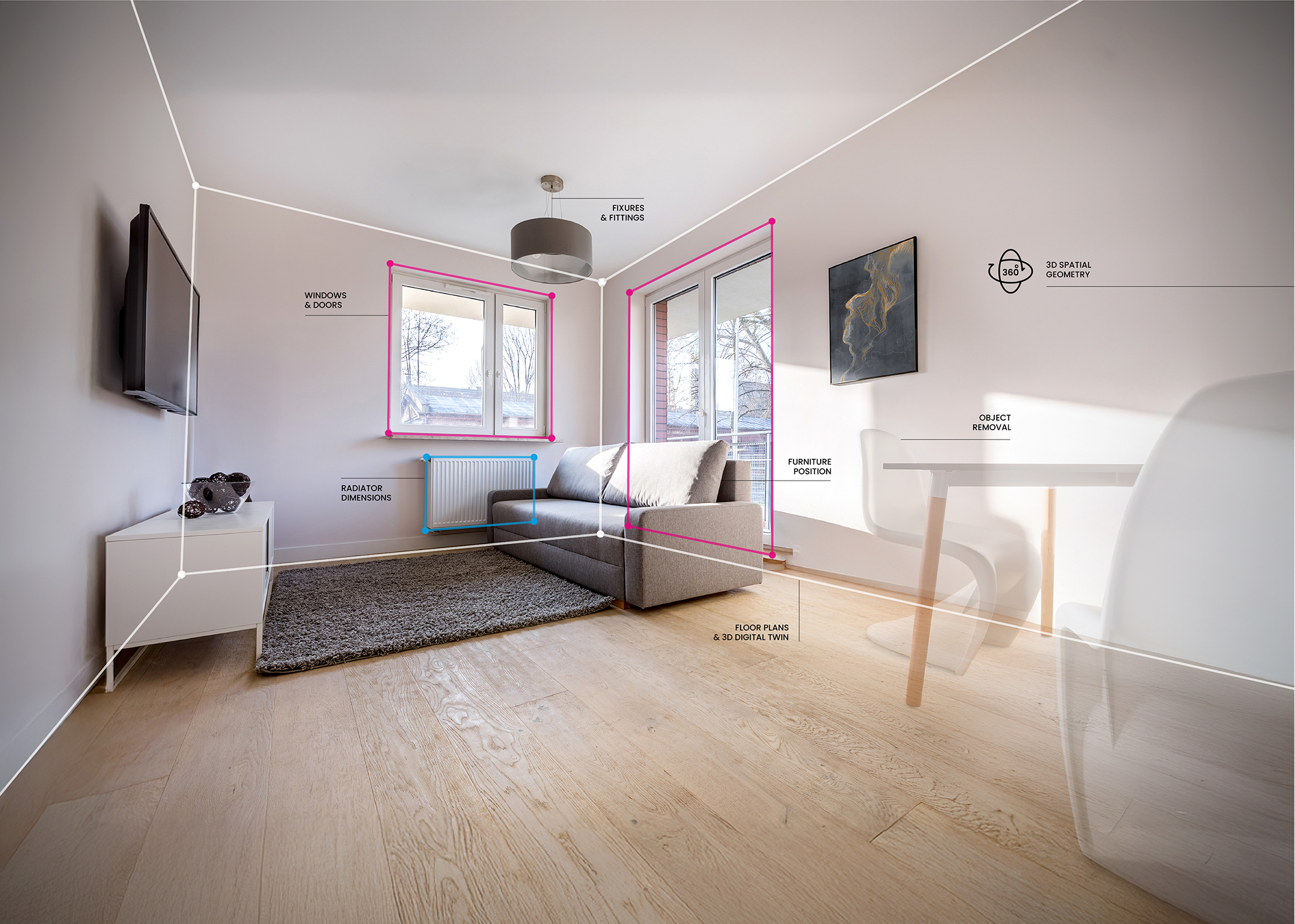
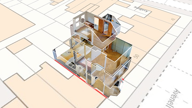
Identify and plan potential renewable upgrades with ease using floor plan, room-by-room measurements, 360° imagery and heat transfer visuals.
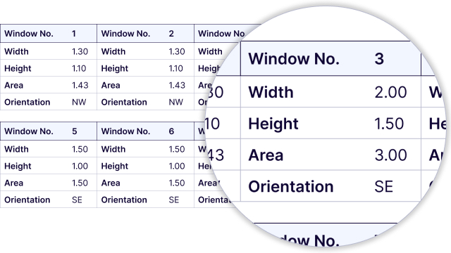
Automate RdSAP10 inputs with measurements, window size & orientation, and Room-in-Roof measurements extraction - all from a single 360° capture.

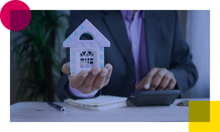
Increase the number of eligible properties for desktop-based valuations with accurate floor plans, key measurements, and immersive 360° imagery - no site visits needed.
Manage large portfolios with structured, remote property data. Vieweet supports Housing Associations, Social Housing providers, and private landlords in streamlining maintenance, ensuring compliance, and gaining full asset visibility at scale.
Assess and manage claims with 360° visuals, accurate measurements and room-level details. Compare 3D models and visual records before and after a claim to validate damage, reduce disputes and maintain a complete, auditable record for every case.
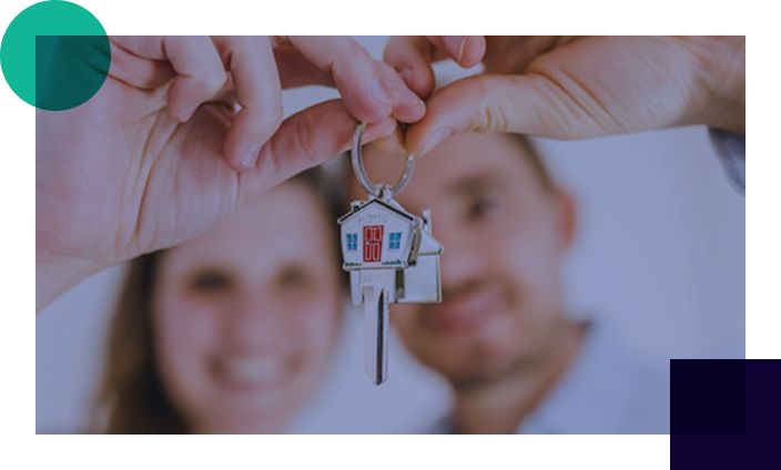
Enhance property marketing, win more listings and reduce the number of in-person viewings with virtual tours, floor plans, and interactive 3D models to showcase properties online.

Complete a 3-bed property in 25-30 minutes vs. 60+ minutes with LiDAR

Hardware from <£300 compared to £2k-£3k+ for LiDAR equipment

High-res 360° panoramas ready to use, no additional setup required

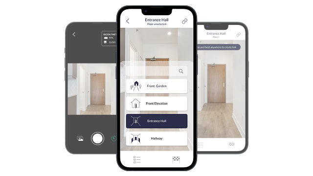
A fully interactive property model for inspections, audits, and measurements (with or without panoramas).

Accurate digital ruler, area calculations, room-by-room dimensions, windows, and heat loss perimeter.

Precise room-in-roof measurements, including slope, flat ceiling, gable, stud and common wall.

Advanced thermal insights for retrofit and energy assessments.

Automatically positions properties for precise location and measurement accuracy.

Seamless integration with existing systems. Export data in multiple formats for any workflow.

A powerful and flexible way to visualise and search thousands of properties at a glance - combining geometry, measurements, energy, historical context, third-party and client data.
Time saved by Energy Assessors producing RdSAP10 reports
Accuracy of measurements
Labelled 360° proprietary images
Of properties captured

Heat Engineer and Vieweet combine 360° visual property data with industry-leading heat loss and retrofit modelling.
By integrating Vieweet’s digital twins directly into Heat Engineer’s software, surveyors can work from accurate visuals and measurements - even in complex spaces - without repeat site visits.
The result is faster workflows, lower costs, improved compliance, and more reliable retrofit planning toward Net Zero goals.

M3 and Vieweet combine trusted asset management and Schedule of Rates data with AI-driven 360° visual property insights.
Together, they help housing providers fully digitalise portfolios, improve data accuracy, reduce site visits, and make smarter investment, management, and retrofit decisions in support of compliance and Net Zero goals.

Vieweet’s 360° capture technology is embedded into EPC Choice’s RdSAP360 app, enabling faster, more accurate EPCs and compliance surveys.
Assessors can capture, review and submit property data digitally, reducing time on site while improving productivity and consistency across EPC Choice’s national network.

FocalAgent and Vieweet combine a national photography network with advanced 360° data capture and AI insights.
Together, they deliver faster, more consistent and cost-effective workflows - from images and measurements to floor plans, condition and retrofit insights - unlocking scalable opportunities across property marketing, energy and valuation.
Vieweet turns a single 360° capture into accurate visuals, spatial measurements and structured reports built to industry standards. Data is fast to capture, easy to scale across single homes or large portfolios, and designed to integrate with third-party systems.
A typical 3-bed home can be captured in 25–30 minutes using a low-cost 360° camera, with no specialist training required. Vieweet streamlines workflows, reduces site time and costs, and delivers consistent, high-quality outputs - so you can do more with less.
Choose DIY or fully managed capture to suit your workflow. Use your own Ricoh Theta camera with full access to the Vieweet app and platform, or let us handle it for you. Through our trusted UK-wide network of 700+ professional photographers, we’ll arrange fast, reliable capture-no effort required.